How to Hike Lough Ouler (Tonelagee) – 2 Routes + Map
This website uses affiliate links which may earn a small commission at no extra cost to you. Thank you for your support.
All you need to know to visit the beautiful heart-shaped lake in Wicklow National Park
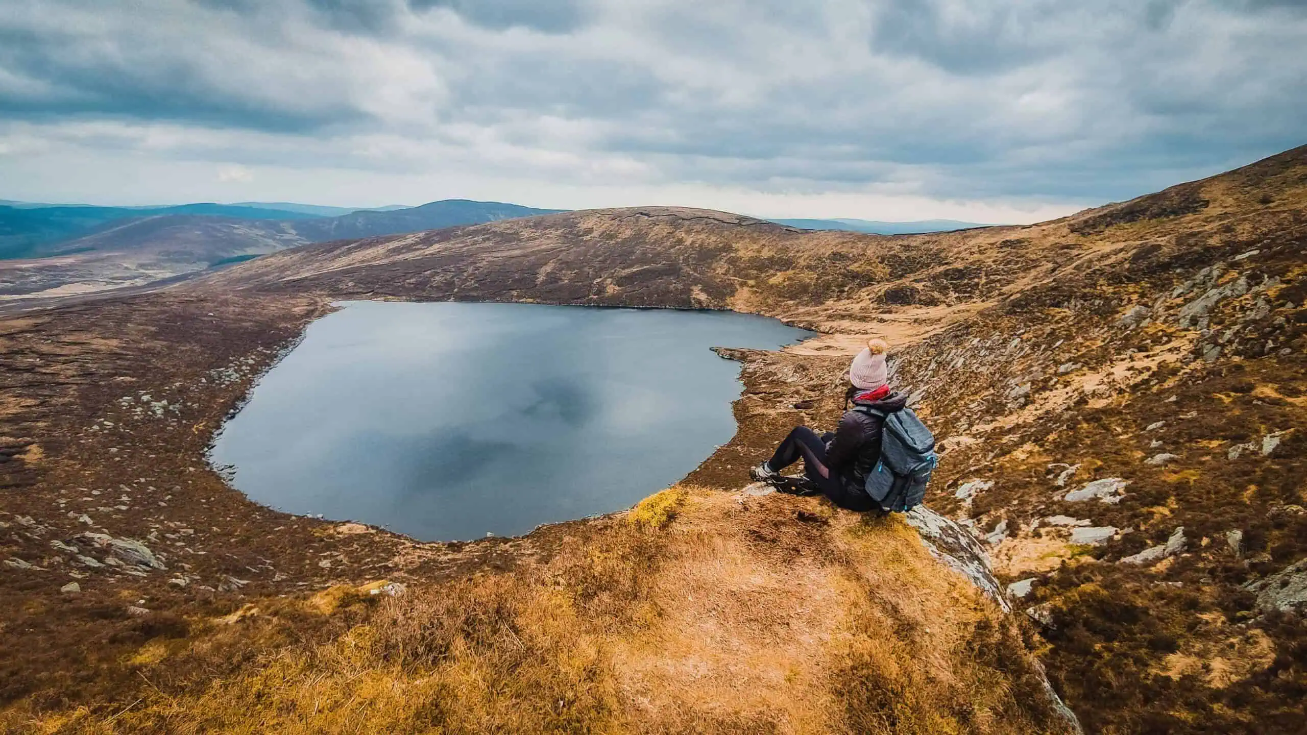
Lough Ouler is nestled under Tonelagee (817m), the 3rd highest peak of the Wicklow mountain range, tucked away in the Wicklow National Park. This beautiful heart-shaped lake is only accessible on foot via a few different trails which are challenging at times, but also worth the effort.
From Tonelagee summit, you will get to admire the picture-perfect heart-shaped lake from above and enjoy a 360° panoramic view over the surrounding rolling landscape. On a clear day, you may even see the Irish Sea.
However, getting to the top of Tonelagee isn’t that straightforward. This hike is not signed posted and if you have never been there, getting started might be confusing at first.
To help you prepare for this beautiful hike, I have created this guide to Hiking Lough Ouler (Tonelagee) which I have completed several times.
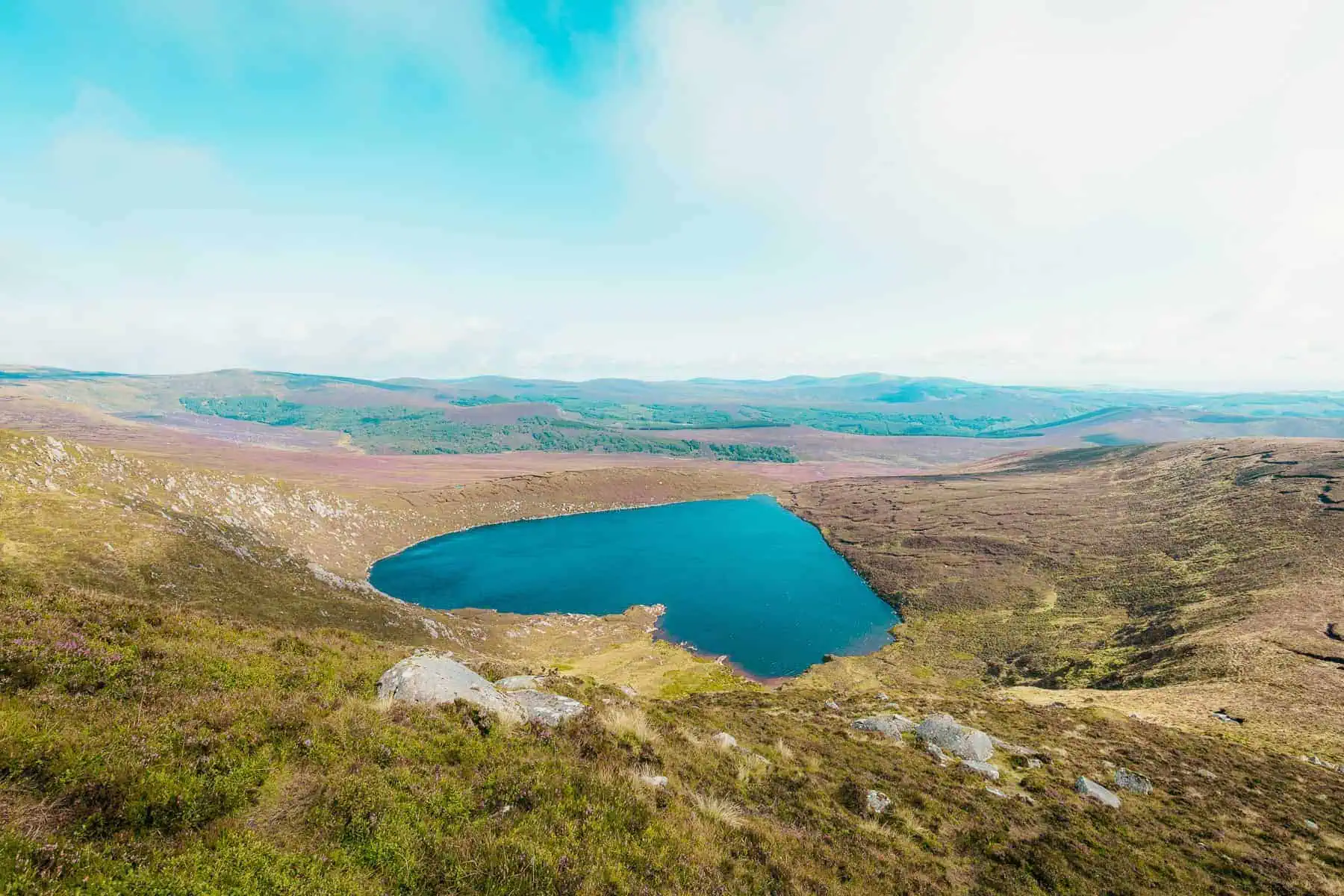

Located within a 1h drive from Dublin city centre, the lake is located in the Wicklow National Park, about 20min from the famous Monastery site of Glendalough.
This heart-shaped lake formed through glacial erosion, which left a steep 200m amphitheatre-like high cliff on the Northeastern side of Tonelagee. The hikes will take you to the top of this mountain from where you will get to see the beautiful lake underneath.
HIKING Lough Ouler – The 2 options
There are two car parks to start the Lough Ouler Hike, one from Glenmacnass waterfall and one from Wicklow Gap. Each trail will get you to the top of Tonelagee but there are several things you should know before choosing which one is right for you.
Glenmacnass Waterfall
Distance: 4km out and back
Difficulty: Moderate
Duration: 2 hours
This challenging trail includes a river crossing, a constant 10 per cent slope through heathery moorlands (often muddy) to a first viewpoint and a challenging final stretch through large boulders.
Wicklow Gap
Distance: 8km loop
Difficulty: Challenging
Duration: 4 hours
A lot shorter, this trail goes from Wicklow Gap car park (also known as Turlough Hill Car Park) and is definitely the easiest way to see Lough Ouler. While it is still steep, there aren’t any complicated sections and the trail is easy to find
It is up to you which you choose, depending on your level of fitness or motivation. Continue reading below to learn how to hike each of them.
ROUTE 1 – Loop Hike from Glenmacnass to Tonelagee

HIKING GUIDE – From Glenmacnass
DISTANCE
8 Km Loop
ELEVATION
450 M
DURATION
3 to 4 Hours
DIFFICULTY
Challenging
TERRAIN
Muddy, Boulders, No Signs, Steep, River crossing
The first hike starts from the Glenmacnass Car Park situated off the Old Military Road, between Sally’s Gap and the village of Laragh. It takes about 1 hour from Dublin city centre to get there or 20 min from Glendalough (10km).
To start the loop hike to Lough Ouler, follow the Glenmacnass River on the right of the car park. About 50 m away, you will see large boulders you can use to cross the river. If the water is too high, walk back towards the car park and on your right, you might find easier boulders across from the forest.
Proceed with extreme caution as the rocks might be slippery.

Once you are on the other side, climb left to the top of the hill that you see straight ahead. Do not go right… this trail is very boggy and leads to the other side of the lake. You can hike up from there, but it is really steep and highly challenging.
So back to the left hill! The trail isn’t signed so you’ll have to look for other people’s footprints. You will be hiking up on a constant 8-10% slope until the “Tonelagee NE” summit. It should take about 45 mins.
From there, you will see Lough Ouler for the first time on the right side. It is the perfect spot for a nice water break or a picnic.
If it is too windy, continue the trail along the lake, you will find a dry bog to your left where you can find a bit of shelter.

From the first viewpoint, the hike gets steeper (about 20%). This is the last stretch to the top! Take your time across the boulders and watch out for slippery rocks.
💡In my opinion, the best views of the lake are halfway through the climb, so make sure to stop and enjoy.
Once you are ready to head back to the car park, follow the path toward Stoney Top, always keeping Lough Ouler on your right. When you see a small standing stone, take the track on your right to go down. This is very steep and it can get muddy. If you don’t feel like it, turn around and go back to your car the way you came.
As you reach flat ground, the path can be tricky to find, try to head towards the river and follow it until you are back to where you started.


Tips & Safety
Getting there ∣ Glenmacnass is only accessible by car (or taxi). No bus lines are stopping in this part of Wicklow National Park.
Car Park ∣ The Glenmacnass car park is large but fills up quickly on weekends so it is best to head out early in the morning. The area is quite isolated with little traffic. Do not leave any valuable belongings at sight in the car when you leave for your hike.
River crossing ∣ Depending on how high the Glenmacnass stream is, the river crossing might be challenging. Falling here can be dangerous, so if you don’t feel safe, turn around. You can still try the second option from Wicklow Gap!
Apps & GPS ∣ You can use an offline App on your smartphone to find your way. I have been using “Maps.me” for years and the hiking routes are always spot on! You can download the map and use the App without an internet connection. “All Trails”, is also a great app for hiking routes. Google maps don’t show the trail unless you use the satellite mode – yet not as easy to use as the other apps.
Nearby by ∣ About 300 m on the left of the car park (toward Laragh) you can see the gorgeous Glenmacnass waterfall and the valley from the road. Just be careful to keep it right when you walk on the road.
ROUTE 2 – Wicklow Gap to Tonelagee hike
HIKING GUIDE – From Wicklow Gap
DISTANCE
4 Km Return
ELEVATION
350 M
DURATION
2-3 Hours
DIFFICULTY
Moderate
TERRAIN
Muddy, No Signs
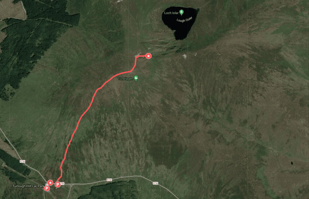
The second route is probably the most popular and also the easiest!
The trail starts near Turlough Hill, at the Wicklow Gap on the R756 road. It is only 15 min drive from Glendalough, or +/- 1.5 hours from Dublin.
To get there, you can drive the scenic route through the Wicklow mountains or via Blessington and the Poulaphouca Reservoir.

Once parked at one of the two available car parks, cross the main road and make your way up the hill which is Tonelagee! The hike up is quite straightforward despite the lack of signposts. Just follow the natural pathway created by other hikers.
The trail goes up for about 45 min but it is manageable. At the top, don’t expect to see the lake just yet. You will have to walk down for another 5 to 10 min until you reach the cliffs. The ground is a bit uneven so watch out for your ankles!
Take the same way you came from to head back home.

EXTRA ROUTE – Laragh to Tonelagee via Brockagh
There are a lot of trails in the Wicklow Mountains and many peaks and lakes can be reached from one to another. Open any digital map and you will see all the routes around the region!
For those who are looking into a moderate 8+ km one-way hike, check out Laragh to Tonelagee via Brockagh Mountains. It’s the blue line on the interactive map below.
I have yet to do this hike. Once done, I will add some details here. Nevertheless, if you have already done it, feel free to leave a comment to share your experience!
SWIMMING IN Lough Ouler
If you want to walk to the lake and touch the water or even jump in for a swim, that’s totally possible.
It is safe to swim but like any other wild swimming in Ireland, proceed at your own risk. The water is quite dark and submerged rocks might not be easy to spot. You can get to the lake from either hiking route and it is a nice way to cool off from the hike!
However, if you arrive from Wicklow Gap (route 2), remember that after your swim, you will have to hike back up to the Tonelagee summit… For those hiking the Loop (route 1), it is a lot easier as it is on the way back to the car park.
If you do not feel like hiking any of the routes above and yet wish to visit the lake directly, you can park at the Glenmacnass Car Park and take the hiking route 1 anti-clockwise. It is flat all the way and it should take about 30-40 min one way.
MAP | HIKING LOUGH OULER ROUTES
ARE YOU ON PINTEREST?
What about saving this post to your Pinterest board?
Click on the photo to save this blog post for later. Follow Travel Ireland Today boards to see our latest pins.

I help you explore Ireland like a local with insider tips, detailed itineraries, and practical advice.
HEY THERE! I’M JEN…
Funder, Author & Photographer behind travelirelandtoday.com
Ireland has been my home for the last 12 years. Before settling here, I spent years backpacking around the globe, visiting 65+ countries. Along the way, I discovered my love for hiking, photography, and crafting budget-friendly itineraries.
Through this website, I share the best things to do and see in Ireland, detailed hiking guides, and practical tips to help you plan your perfect Irish adventure. Let’s make your trip unforgettable!