Hiking Lough Bray in Wicklow, Ireland
This website uses affiliate links which may earn a small commission at no extra cost to you. Thank you for your support.
A moderate but short hike overlooking two beautiful lakes, the Dublin Mountains and the Irish Sea.
Lough Bray Upper and Lower are two of the many black lakes found in the Dublin and Wicklow Mountains. Partially visible from the road, the lakes truly show off their beauty to those willing to put in a bit of effort and hike!
In this article, you will learn about the different hiking trails to see both Lough Bray as well as where to park and what to see. We will also share how to add Kippure Summit to your hiking route to make it more challenging!
Here is a short but complete guide to hiking Lough Bray in Co. Dublin, Ireland.
Getting to Lough Bray
Lough Bray is located in Wicklow county, only 25km south of Dublin City Center. Without traffic, it takes about 35 min to get there via the Old Military Road. However, like many other places around the Wicklow Mountains such as Lough Ouler, the area is secluded and only accessible by road. There is no public transport passing by and the only way to visit this part of Ireland is to either drive or cycle!
There are two car parks close to Lough Bray. Coming from Dublin, the closest car park (Quarry car park) is located on the left side of the road, across from the lakes. It is a very popular place to park and visitors come and go all day long. I would recommend parking here if you intend to walk the Lough Bray Upper Loop or Kippure summit via Lough Bray.
The second car park can be found at the Glencree Barracks. It is a little bit out of the way, but a lot safer to park nearby the Lough Bray Upper & Lower Loop hike starting point than parking on the side of the road.
Moreover, Glencree Barracks is a nice little spot to add to your day trip if you are interested in learning about the region or enjoying a post-hike coffee and snack. It hosts the Armoury café, the Centre for Peace and Reconciliation, a German Military cemetery as well as a grotto dedicated to Our Lady of Reconciliation.
Tips to travel and park at Lough Bray
- The Old Military road is quite popular with cyclists so be mindful as you meander through the mountain roads. Hikers also often follow this road to get back to their car after the Lough Bray Loop hike.
- Make sure to park at the designated areas and not along the road to avoid traffic jams or put other visitors in danger.
- Lough Bray is only accessible by road – There are no bus stops nearby.
- The Lough Bray car park is large but fills up quickly on weekends so it is best to head out early in the morning.
- The area is quite isolated with little traffic. Do not leave any valuable belongings at sight in the car when you leave for your hike.
- The area around the lower lake at ground level is private, including the beach and the paved road alongside it.
what you should know BEFORE HIKING LOUGH BRAY
- There are countless shortcuts and potential hiking routes in Dublin and Wicklow Mountains. Lough Bray Loop hikes are not signposted so make sure to be prepared and do some research before your hike. You can use offline maps on your phone. I personally use “Maps.me” as I find the hiking routes always spot on!
- If you don’t feel safe, turn around. Offline maps sometimes show trails that do not exist, so trust your eyes and follow well-worn paths only.
- Always wear proper hiking shoes as the trails can be muddy and slippery.
- Be aware that people with vertigo may also struggle in a couple of places along this hike.
- Do not venture on this hike in bad weather. It can be dangerous to walk on the rim with low visibility, strong wind or on snowy/rainy/stormy days.


ROUTE 1 – Lough Bray Upper & lower LOOP Hike
The Lough Bray Upper and Lower loop hike will take you around both lakes. It is a nice 7 to 9 km trail that follows the Mountain rim on the west side and follows the lake level on the eastern part.
If you start at the Glencree car park, you will find the first trail about 500 m up the road on the right side near the “3 road signs”. This trail which goes through high ferns at first will quickly lead to a well-worn path up the hill.
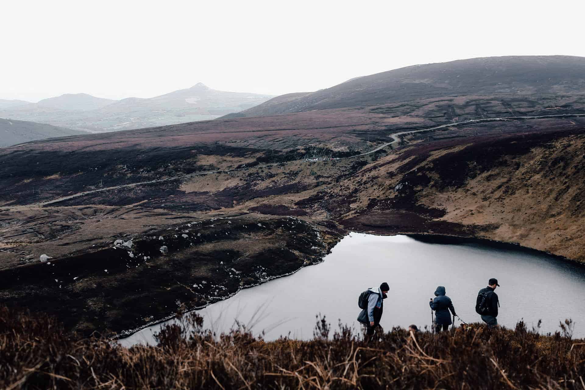
Follow the trail anti-clockwise until you reach “Eagle Crag”, a couple of giant granite boulders that dominate the valley. Step on top of the dramatic promontory while keeping a safe distance from the cliffs and enjoy the spectacular panoramic view of the two lakes, the military road and the iconic Sugar Loaf in the background.
After a well-deserved break, continue your hike to the right. You will quickly arrive on the other side of Lough Bray Upper, near the Quarry car park. To reach Glencree, take the trail just below the road, and walk downhill to the lake.
Continue on the Upper lake shoreline for a bit and cross over to the Lower lake, always keeping the road on your right, until you catch sight of the small cottage off the Old Military Road. From there you can follow the road back to your car (be extra careful).
Note: You can cut the walk short by going down from Eagle Crag. Though, this path is very steep across boulders and should be for experienced hikers only.
If you park at the Quarry Car Park, I would recommend approaching the loop clockwise. The elevation gain is a lot more manageable this way and the trail easier to find!
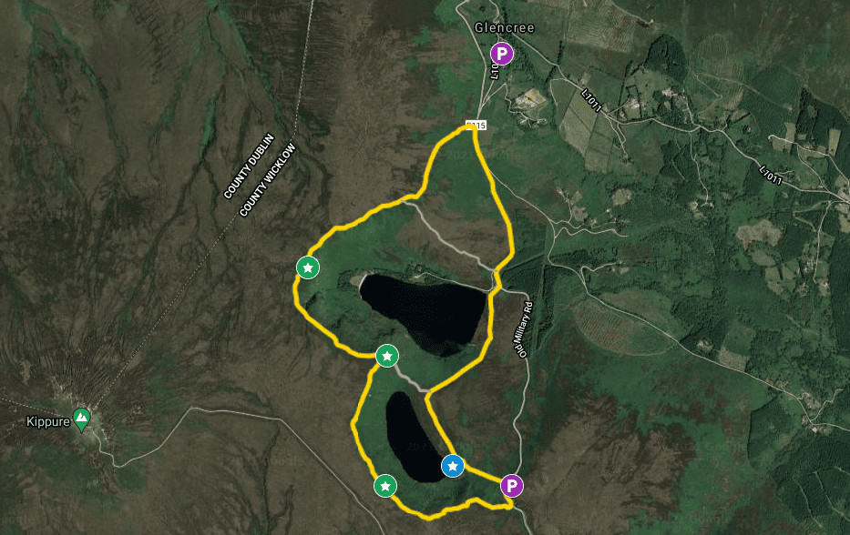
LOUGH BRAY upper & Lower LOOP TRAIL – HIKING Guide
Distance: 7-9km loop hike
Elevation gain: 290 m
Time: 2 to 3 hours
Difficulty: Moderate
Accessibility: Can be muddy – Not recommended for people with vertigo
On the Map: Yellow Line = Main trail // Pink line = shortcuts

ROUTE 2 – Lough bray upper loop
This second route is my favourite. It is short, highly rewarding and moderate enough for a nice 2 hours workout! A quick win for those that don’t have much time.
The trail starts across from the Quarry Car Park, right on the Old Military Road. The hike starts about 200 m on the left and is quite straightforward despite the lack of signposts. Just follow the natural pathway created by other hikers and keep the lakes on your right.
The trail goes up a little at first and remains flat until you reach Eagle Crag. From there, the views are incredible, mostly if you get to hike on a sunny day. I would however suggest walking a little bit to the left as if you were going to hike the full loop described above.
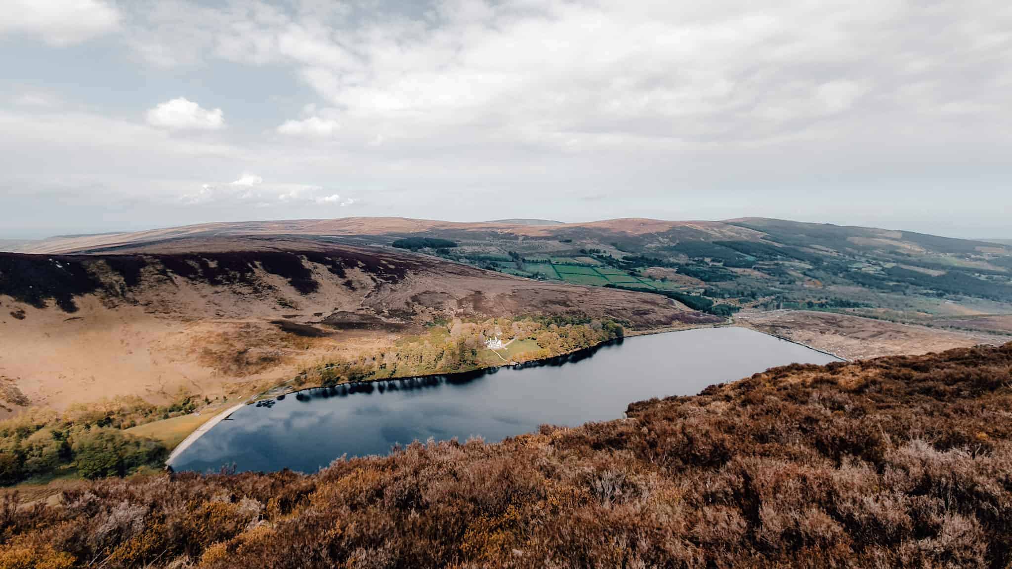
Only 200-300 m along the path, the bird’s-eye view of the Lough bray Lower, its beach and the Lodge are a lot more attractive!
At Eagle Crag, follow the trail down through the boulders. It can be very slippery so be extra careful. At ground level, you can either walk on the main path or look for a secondary trail on the right side that follows the Lough Bray Upper shoreline.
Once you reach the end of the lake, you will find a nice spot to touch the water or even go for a quick swim… From here, the path will go back up a little for about 50 meters until you are back to the main road.
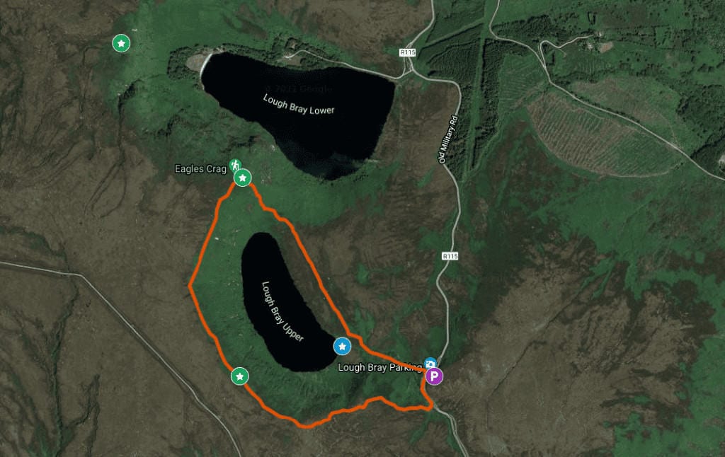
Lough bray upper loop – HIKING Guide
Distance: 3.5 km Loop Hike
Elevation Gain: 150 M
Time: 1.5 Hours
Difficulty: Moderate
Accessibility: Can Be Muddy – Not Recommended For People With Vertigo
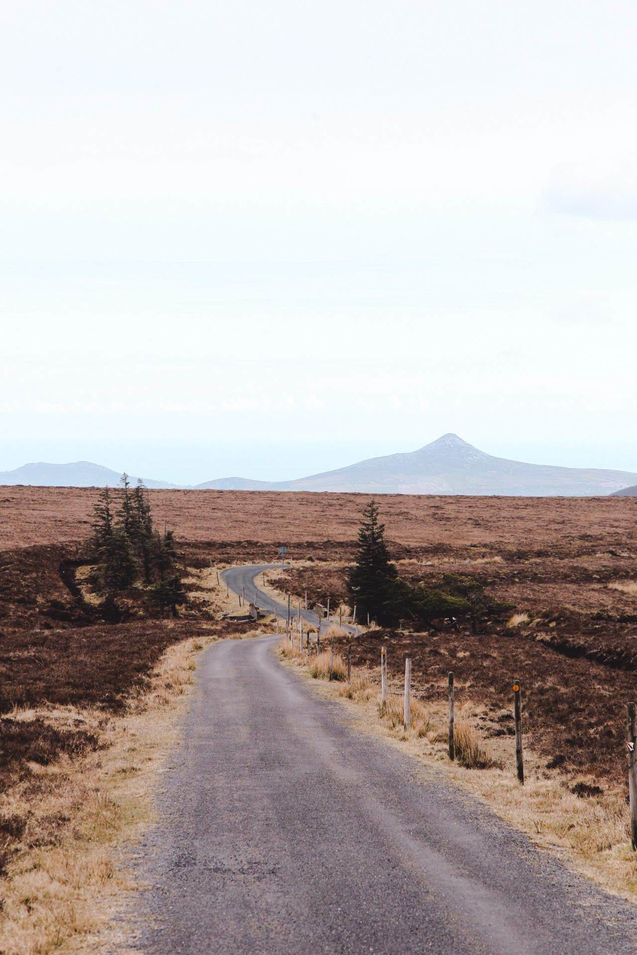
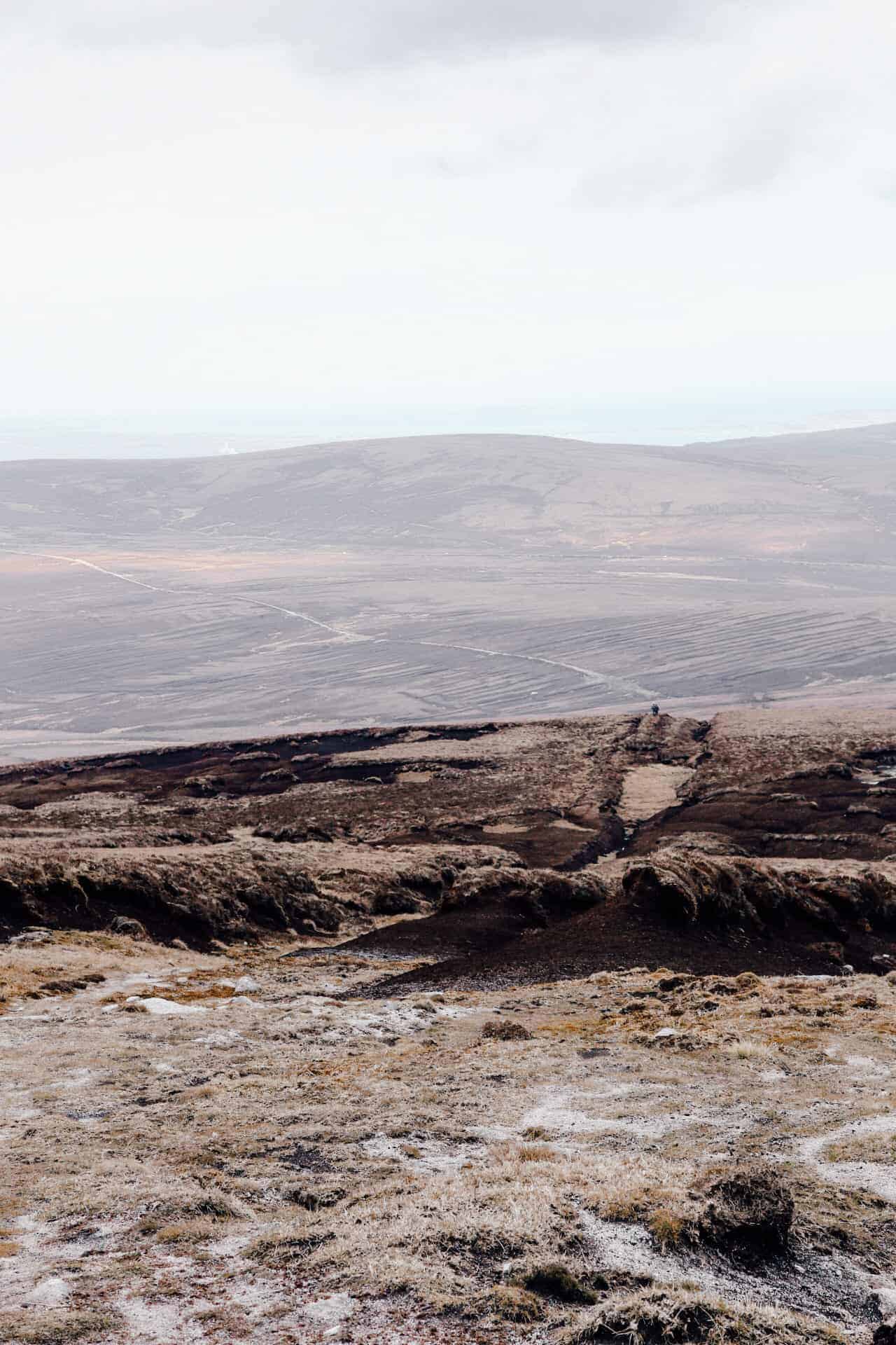
a detour to Kippure summit via lough bray
For those who are looking into a longer and more challenging hike in the area, why not add Kippure summit to the Lough Bray loop hike? This itinerary follows the Lough Bray upper loop hike but adds on a detour to Kippure. It involves in some part walking off trails, so if you venture this way, be aware you will have to self-guide across the bog and grown heathers.
There are actually only two parts that require going off-trail, but not for too long. The first one is at the 1.5km mark off the Lough Bray Upper hike (clockwise loop from the Quarry car park).
It is necessary to go off-path here, to catch up with the Kippure TV maintenance road that you will then follow all the way to the Summit topped by a 110 m antenna. It only takes 5-10 min but it can be challenging if it has rained the previous days.
If you don’t want to start at Lough Bray, you can instead follow the Old Military road for about 1.2km after the Quarry car park towards Sally’s Gap, and turn right on the paved Maintenance road.
Once at the summit, you can either go back the way you came or follow a straight path for 1.7km and turn right through the bog to catch up with the Lough Bray Trail on the Lower side. There are no trails, but you can easily find other people’s footprints.
The field is uneven and there are a few water streams that require crossing. I would not recommend this to novice hikers who have never gone off-trail before.
This hike is really nice. On top of being a little bit more challenging than the other routes, it also offers incredible views of Dublin city, the Wicklow mountains, the Irish Sea, and even the Howth Peninsula!
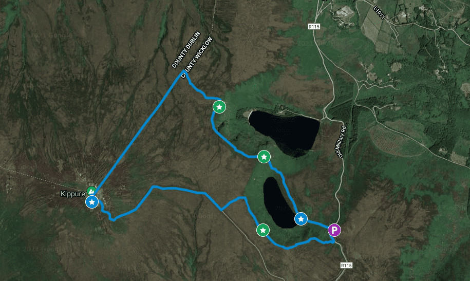
KIPPURE VIA LOUGH BRAY – HIKING Guide
Distance: 9 km loop hike
Elevation: 380 m
Time: 3 to 4 hours
Difficulty: Moderate
Accessibility: muddy, no signs, cut through bog and uneven field.
MAP | HIKING LOUGH BRAY ROUTES

ARE YOU ON PINTEREST?
What about saving this post to your Pinterest board?
Click on the photo to save this blog post for later. Follow Travel Ireland Today ‘ boards to see our latest pins.

I help you explore Ireland like a local with insider tips, detailed itineraries, and practical advice.
HEY THERE! I’M JEN…
Funder, Author & Photographer behind travelirelandtoday.com
Ireland has been my home for the last 12 years. Before settling here, I spent years backpacking around the globe, visiting 65+ countries. Along the way, I discovered my love for hiking, photography, and crafting budget-friendly itineraries.
Through this website, I share the best things to do and see in Ireland, detailed hiking guides, and practical tips to help you plan your perfect Irish adventure. Let’s make your trip unforgettable!