Lacken Mass Path Hike to Sorrel Hill in the Wicklow Mountains
This website uses affiliate links which may earn a small commission at no extra cost to you. Thank you for your support.
Lacken Mass Path is a lovely trail that remains off the beaten path in West Wicklow. Combined with Sorrel Hill summit, it is a great two- to three-hour hike with exceptional views. Perfect for a Sunday walk away from the crowds!
The Mass Path was once a walking route used by locals to go to church, school and even the pub! It winds through farmland, crosses dense forestry, and eventually opens into exposed bogland.
Along the way, expect to share paths with grazing sheep, cross woodland trails, and navigate some boggy sections before reaching Sorrel Hill summit. The reward? Breathtaking views over Blessington Lake and the rolling Wicklow hills.
Before walking Lacken Mass Path to Sorrel Hill in Wicklow, here are all the details you need.
Lacken Mass Path to Sorrel Hill Map

Getting There & Starting the Hike
The hike begins in the small village of Lacken, where most people park near the Church of Our Lady of Mount Carmel.
Parking is limited to a dozen spaces, so consider arriving early or parking in nearby locations if attending during busy hours (church/mass hours).
Finding the Trailhead

From the car park, walk back up the road you came down.
Look for a gap in the stone wall with steps and a sign for “Mass Path”—this marks the official start.

Climb the stairs and walk about 25 m until you reach the road.
Pass through a gate onto the road and turn right, following the Mass Path sign on the pole.

After about 50m, on the left side of the road, you’ll see a blue boat flowerbed with another sign for the Mass Path. Turn left here.

Pass through a wooden gate marked “Mass Path” and “No Dogs Allowed”.
Ensure you close the gate behind you to protect livestock.
The Trail Experience
First Section: Farmland & Forest
The trail begins with a gentle incline, leading through a landscape of gorse bushes (furze). As you walk, you’ll encounter several gates. These are designed to keep sheep from wandering away, so always close them behind you after passing through.
After about 900 m, you will arrive at an expansive pastureland where sheep roam freely, and the open terrain provides a stunning first glimpse of Blessington Lake.
Be sure to turn around and take in the view.


The path is well-marked and guides you across the farmland, but it’s important to stay on the designated route to respect the animals and the farmer’s land.
After a short incline across the farm, you’ll encounter a small river crossing and a wooden stile leading to the edge of a forest.

Forest & Bogland Section
Once you cross the stile, turn right towards Lugnagun (there is a sign) and follow the narrow forest path, weaving through the trees and crossing two fire roads. There are “Mass Path” signs along the way, helping guide the way, but they can be small and somewhat hidden, so be sure to keep an eye out.


Final Ascent to Sorrel Hill
Once outside the forest, you will leave Lacken Mass path behind and continue along an unmarked mountain trail stretching through exposed grassy bogland.
The terrain here is a bit rugged and uneven, requiring careful footing, especially after wet weather when the path becomes muddy.
The trail is quite easy to follow on a sunny day, but don’t forget you are in the montains and weather can turn quickly. Always bring a charged phone with GPS or a GPS Device with you.
The final ascent to Sorrel Hill begins as you approach the 3 km mark. The incline gradually increases, leading you up towards the summit.


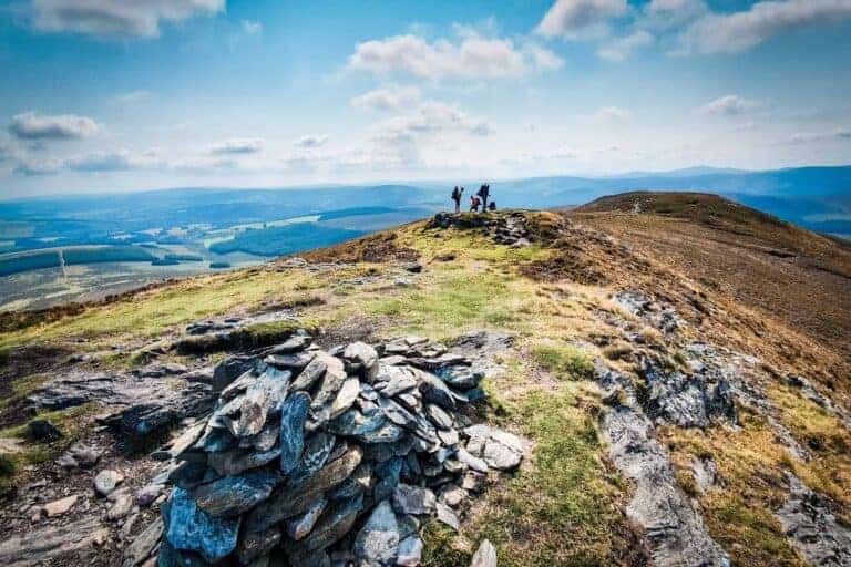
The effort is well rewarded at the top, where a large stone cairn marks the peak.
From here, the views are breathtaking. Blessington Lake shimmers below, while the surrounding mountains of Wicklow offer a peaceful panorama.
Returning to the Trailhead

The Lacken Mass Path to Sorrel Hill is an out-and-back hike, meaning you’ll retrace your steps to return to your car. Descend carefully, especially through the muddy bog sections, and enjoy the different perspectives of the landscape as you make your way back.
Difficulty & Tips for Hikers
- Duration: 2 to 3 hours (depending on pace and weather conditions).
- Difficulty Level: Easy to Moderate.
- Navigation: The Lacken Mass Path is well-marked, but the trail to Sorrel Hill is not (though easy to find). However, always keep your phone charged and consider using an offline map or GPS Device.
- Pet: The route crosses farmland with livestock which means it is not Dog-friendly (even on lead).
The hike itself is not too demanding and the first sections are straightforward. The elevation gain isn’t challeging and people in good fitness won’t get too tired as the steepest part is very short.
However, because of the bogland and uneven ground near the summit, I would rate this as moderate.


What to Bring
- Footwear & Clothing: Waterproof hiking boots are highly recommended due to the boggy sections.
- Layered clothing: Layered clothing is essential, as Irish weather is unpredictable, you could start in sunshine and reach the summit in rain or strong winds.
- Snacks & water: there are no facilities along the hike or at the village.
- Offline map or GPS: while the trail is marked, some signs can be small or easy to miss
Respecting the Land & Livestock
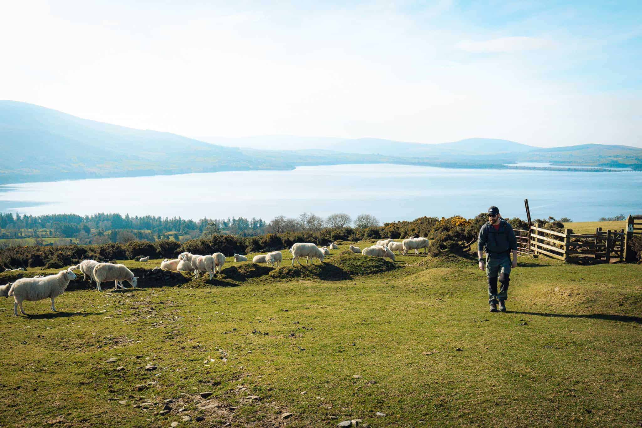
On this hike, you’ll cross private farmland with grazing sheep. Always close gates behind you to protect livestock and farmland. Do not attempt to touch, feed, or chase them.
If they’re on the path, allow them to move at their own pace without disturbing them. Stick to the marked trail to avoid damaging farmland or getting lost.
Post-Hike Recommendations
After completing the hike, there are a few great spots to grab a well-earned meal or coffee nearby:
- Hollywood Café (Hollywood, Co. Wicklow): A charming café known for its Reuben sandwich, Irish breakfast, beef stew, and falafel.
- Brew 21 & Vida (Blessington town) – Perfect for a hot chocolate or coffee after your hike.
- Local Pub Near the Church – While I didn’t visit, I know it’s a popular spot for post-hike drinks.


What to do nearby
Here are some extra activities if you want to make the most of your day in the area. Yoy may also like these other hikes in the vicinity.
Water sport on Blessington Lake
For those looking to extend their adventure beyond hiking, Blessington Lake offers the perfect opportunity for water-based activities. Spanning over 5,000 acres, this vast reservoir, also known as Poulaphouca Reservoir, provides a tranquil and scenic setting for kayaking, stand-up paddleboarding (SUP), and even wild swimming for the brave.
If you have your own paddleboard or kayak, there are several launch points around the lake. One of the most accessible is Poulaphouca Lake Parking, where you can easily park and carry your board down to the water.
If you don’t have tour own board or kayak, check out CPAdventure to join a kayaking tour. You can also join the Blessington sailing club or the Poulaphouca Paddlers.
The Blessington Greenway
For a more leisurely way to explore the area, the Blessington Greenway offers a stunning 5 km scenic trail, ideal for walking, running, or cycling. This well-maintained route follows the eastern shores of Blessington Lake, winding through beautiful woodland, open meadows, and lakeside paths, providing spectacular views along the way.
Avon is a great place to start your trip and rent a bike if you don’t have your own. The Greenway is an accessible and family-friendly option, with a relatively flat and easy terrain suitable for all fitness levels.

Wicklow Mountains Drive
If you’re in the mood for more breathtaking views but want to take a break from hiking, a scenic drive through the Wicklow Mountains is a fantastic way to explore the area. The Sally Gap Drive is one of Ireland’s most iconic road trips, taking you through dramatic landscapes, rolling moorlands, and some of the most photographed spots in Wicklow.
Starting from Blessington, take the road towards Manor Kilbride, where the countryside begins to unfold into rugged hills and quiet valleys. As you ascend towards Sally Gap, you’ll be surrounded by open bogland and exposed mountains, often with sheep grazing freely by the roadside.
One of the must-see stops along the way is Lough Tay, famously known as Guinness Lake. This small yet striking lake, set against the backdrop of the Luggala Estate, is named for its dark waters and white sandy shoreline, resembling a pint of Guinness. It’s one of the most photographed lakes in Ireland, offering an unmissable panoramic view from the roadside viewing point.
Final Thoughts
The Mass Path hike to Sorrel Hill is a fantastic choice for those looking for a peaceful yet rewarding walk in the Wicklow Mountains. It’s a short hike, not too demanding and offering incredible views without the crowds. A great spot for an afternoon stroll in Wicklow Mountains.

ARE YOU ON PINTEREST?
What about saving this post to your Pinterest board?
Click on the photo to save this blog post for later. Follow Travel Ireland Today’s boards to see our latest pins.

I help you explore Ireland like a local with insider tips, detailed itineraries, and practical advice.
HEY THERE! I’M JEN…
Funder, Author & Photographer behind travelirelandtoday.com
Ireland has been my home for the last 12 years. Before settling here, I spent years backpacking around the globe, visiting 65+ countries. Along the way, I discovered my love for hiking, photography, and crafting budget-friendly itineraries.
Through this website, I share the best things to do and see in Ireland, detailed hiking guides, and practical tips to help you plan your perfect Irish adventure. Let’s make your trip unforgettable!